Friday, April 27, 2018

February 26 - Day 12 in Big Bend National Park - Cattail Falls

A few episodes ago I mentioned that a waitress gave us a tip about an excellent destination that isn't on the maps or mentioned on the NPS Big Bend web site. That was going to be our main destination for today, but first we revisited the Nature Trail in the campground. We only had 2 more days in the park and we were hoping for a new bird or 2 before we left. We didn't have any luck, so we headed towards the Ross Maxwell Scenic Drive.

The hike begins at a gated gravel road with no signs indicating anything is down there. We hiked for about 2 miles, passing another gate, then arrived at small oasis area. Here we found a creek that barely had any water in it. I was actually surprised that there was any water since this area is really suffering from a drought. The road also split here. One trail headed up towards The Window and the other led to Cattail Falls. There was also a big sign with a picture of Cattail Falls, some info about the area, and pictures of some of what we might see at the falls. A huge oak tree had made it's home here, so we took advantage of the shade and spent some time hanging out.

the view from the beginning of the road
Cindy and me at the big oak
I wonder how many days out of the year the waterfall has that much water!


The trail from the oasis to the waterfall is about a mile and just about immediately heads into the usual desert environment we have been hiking in for most of the trip. As we got closer to our destination - Cattail Canyon - we began to parallel a deep and wide dry wash which I believe is Cattail Creek. The wash and trail narrowed as we approached the canyon and we began to see small pools. The pools began to get bigger and water flow from one to another was very apparent. The vegetation was now thicker and new spring growth was all around us, even though the trees haven't leafed out yet. We had to climb over and around a few large rocks at the end, but were now in front of the 80' Cattail Falls and the surrounding rock walls. The waterfall was barely a trickle, but I was very surprised that there was any water coming over the falls at all. There was a man leaving just as we got there and he was the only person we saw on the trail all day.

view approaching Cattail Canyon
the dark area is the trickling Cattail Falls
Cattail Falls

You can't see any water flow in the pictures above, but in the last photo you can see the pool in front of the falls. Since the waterfall didn't make a good photo subject, we began looking for any kind of life around this oasis. I joined iNaturalist.org a while back, and knew that some of the life I saw on our trip would be unique for me. Briefly, iNaturalist is a citizen science project where anyone from anywhere can enter observations of life - plant, animal, insect, etc. Here's a bit of what we saw.

Spring Azure (Celastrina ladon)

Springwater Dancer (Argia plana)

Black Maidenhair Fern (Adiantum capillus-veneris)

Tropical Leafwing (Anaea aidea)

Comanche Paper Wasp (Polistes comanchus ssp. comanchus)

Cedar Sage (Salvia roemeriana)
It was now late afternoon and we had a 3 mile hike back to the truck. This is a place you just do not want to leave. As we started out we couldn't help ourselves and stopped for some shots of the first pools we saw before getting to the falls.


Monday, April 23, 2018

February 25 - Day 11 in Big Bend National Park - Chimneys Trail

We hiked the Chimneys Trail today which turned out to be an excellent hike and destination. The Chimneys are a "series of prominent volcanic dike formations" according to the NPS web site. The hike is almost a 5 mile round trip, but isn't that difficult since there isn't that much elevation change. We got an early start hoping to catch a sunrise along the way. The sun did rise, but the skies were clear. We stopped anyway as the sun began to clear the mountains, then again when we spotted some interesting side light.


We were the first vehicle at the trail head again and actually didn't see anyone else until we were almost ready to leave. The entire trail is through desert vegetation, so there wasn't really any interesting geology along the way. We did look for plants we hadn't seen yet, more reptiles (nope), and birds along the way. We spotted what we are pretty sure were Scaled Quail, but didn't get a picture, so won't count in as a new bird. Below are a few shots stating from the trail head to when we got to the Chimneys.

view towards our destination from the trail head
Cindy shooting a Yucca along the trail
the Chimneys in view
the Chimneys with Santa Elena Canyon in the background

just about there!
The NPS web site has a picture of an arch on this trail, but so far we hadn't noticed one. We continued up the trail between the 2 rock formations and that's when the arch came into view. It's not a big one, but still very cool. Short scramble trails lead up for a closer view of the rocks and arch. Here's a bit of what we saw.

the arch

Cindy and me in the arch
from the other side of the arch
looking towards Santa Elena Canyon
looking back towards the parking area and beyond
The Chimneys also offers the opportunity to see Native American artifacts and markings on some of the rock walls. We weren't sure exactly where to look, but found some of what is there.

It appears that this ledge was used for something in the past.
a different angle of the ledge

A closer examination of the wall reveals carvings.

stone artifact
another stone artifact
It was now early afternoon and we took our time on the 2 1/2 mile hike back to the truck. As we were leaving I snapped some shots of the large rock piles where we found the artifacts. Once we got back to the trail head, we both agreed to head back to the camp site and relax the rest of the day.


Sunday, April 15, 2018

February 24 - Day 10 in Big Bend National Park - Tuff Canyon and a sunset

While researching things to do in Big Bend and the surrounding area, Cindy came across something called the Terlingua Ghost Town. Terlingua is a small town not too far from the west entrance of the park. We decided to make that our first stop of the day and also planned to eat our big meal of the day in that area so we wouldn't have to cook later at the camp site. Terlingua isn't a very big place, but it took us a while to find the ghost town. When we did, we discovered it was no more than a tourist trap and not the photo op that we thought it would be. The general store there did have a lot of souvenirs and local merchandise if that's what you happen to be looking for. We did find an excellent local Tex-Mex cafe called the Chili Pepper, so the trip wasn't a total bust. The waitress also gave us an excellent tip about a spot in the park that isn't on the maps called Cattail Falls. More on that in a future post. Near the west entrance to the park is one of the standard national park signs, so we stopped on the way back in to get a picture. I had the 10 second timer on and caught Cindy holding her hat just as a gust of wind was trying to blow it away.


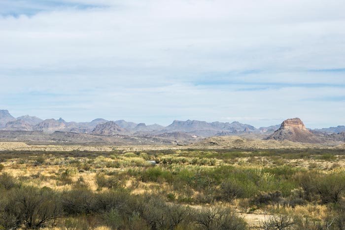
Next on the list of activities for the day was a short hike to 2 old homesteads on the Dorgan-Sublett Trail which is in the SW area of the park in the Santa Elena Canyon area. Apparently the Dorgan and Sublett families had a fairly large farming operation in the area in the early 1900's. The first stop on the trail is what's left of one of the old farm houses, but I didn't find it interesting enough to take a picture. Surely this would be a good spot for a lizard to hang out, though. If there was one, it saw me coming and ran for cover. The next building on the trail was where the farm hands lived. No cold blooded creatures here either, but some mean looking wasps had taken up residence. The trail ends at what's left of the Dorgan house with nice views of valley.

view of the Santa Elena Canyon
Golden Paper Wasps

valley view with the Rio Grande River
another valley view
the Dorgan house

Our next stop was just up the Ross Maxwell Scenic Drive for the short hike into Tuff Canyon. The whitish rock making up the walls of the canyon is called tuff, which is welded volcanic ash. The hike begins with view points down into the small canyon, then descends into the canyon itself. As we got to the bottom of the trail just before the canyon, I caught movement out of the corner of my eye. "Nobody move!!" It was a little lizard trying desperately not to be seen. Slow movements getting the camera ready - don't look it in the eye! - snap, snap, snap, and I finally have my first reptile shot! I had no idea what it was and didn't care if it was the most common lizard around.


Greater Earless Lizard  (Cophosaurus texanus)
Feeling quite satisfied, we continued hiking up the wash into the canyon. This canyon didn't have the 'wow' factor that the Santa Elena Canyon had, but it was still very interesting. There were numerous holes of various sizes hollowed out of the walls - I'm assuming from water gushing down through the canyon over the years. I was able to get into one which held a large rock that wasn't prone to erosion.


note Cindy in the picture for perspective


From here we went back to the campground to get cleaned up, then headed back out again in hopes of catching a colorful sunset. The place we chose was just a few miles up the road and had views to the west plus a view of the Sierra del Carmen mountains to the east. We were hoping the late afternoon light would look good on the mountains. The sunset wasn't quite what we hoped for. As the sun set, the clouds dissipated and became focused closer to the horizon, but that area was very colorful. It was still really pretty and a great way to end the day!

looking towards Sierra del Carmen