Thursday, December 31, 2015

December 29. 2015 - Little Bird Falls, Pisgah National Forest


Little Bird Falls - Pisgah National Forest

Today had to be a waterfall day.  There's been a LOT of rain here lately and the creeks are gushing!  My plan was to go to Moore Cove Falls, Little Moore Cove, then some smaller unnamed waterfalls nearby.  I got a late start and by the time I got to the Moore Cove Falls parking, it was full - dang.  I did have a Plan B, so I continued up 276 towards the Parkway.  Water was just pouring off of the mountains on the way up and there were creeks and waterfalls in places where there is normally nothing.

Plan B was to return to a small waterfall Harry and I had been to years ago - Little Bird Falls.  At the time, water flow was very low and I guess I thought it wasn't worth putting on my site.  That was a mistake.  It's on there now, and you can click here for directions and particulars.  The Parkway is still open because of all the warm weather, so I took it south to NC215 and headed north down the mountain.  Again, the mountains were oozing water.  Bubbling Spring Branch was a gusher, but I didn't stop for a picture.  First stop was going to be Little Bird Falls.  Parking is tricky because you just pull off along the road there Green Creek goes under 215.  The shoulders were very soft and I ended up parking down the road and walking back to the creek.  Green Creek is normally a low volume creek, but it was very full today.  The water was very clean and clear also.

I ended up spending a couple of hours here shooting stills and video and had the place to myself the entire time.  I used to shoot with a Sony a77 a-mount camera, but in June I switched to an a6000 which is Sony e-mount.  I recently bought and adapter so I could use my a-mount lenses on the a6000 and I was having fun testing the new combination.  Below are a few more shots and a video of Little Bird Falls.


From here, I headed back up 215 towards the Parkway.  I also passed Sunburst Falls on the way down and wanted to stop for shots there.  The creek and waterfall here were really flowing hard also.  There were other people here and cars stopping on the bridge so the drive-by shooters could get their shots, so I didn't stay long.

Sunburst Falls
 

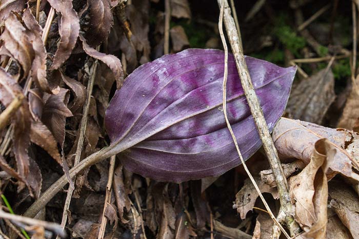
I'm kind of glad Moore Cove was full when I came by earlier because now there were people parked all up and down the road and the visit would have been miserable.  If you like wildflowers also, put Little Bird Falls on your list for Spring hikes.  It looks like it will be a great spot!

Thursday, December 24, 2015

December 21, 2015 - Holly Rd and Moore Cemetery Rd - DuPont State Forest

If you are looking for an easy stroll in a beautiful section of the forest, this is a hike you should consider.  My guess is that 99% of the people that pass this trail head never take it.  Parking for the Holly Rd trail is the Hooker Falls access area.  The trail begins on the gated road on the right just before you get into the upper parking area.  To be honest, I've never noticed it in all the times I've parked in this lot.  It just looks like a service road.

Begin the hike just beyond the green gate and in a very short distance, come to the Moore Cemetery Rd trail on the left.  This trail is only 0.2 miles and ends at the old Moore Cemetery.  It looks like this section of the forest hasn't been disturbed in years and there were several very large white pines along the way and near the cemetery.  As you can see from the photo, many of the head stones are just slabs of rock marking the graves.  A few were etched with the names and dates which were from the late 1800's.

Moore Cemetery

I had decided not to bring my tripod along on this hike thinking there wouldn't be that much to shoot - big mistake!  After we got back on Holly Rd, we came to a stacked pile of logs in an open area and on these logs were a wide variety of mushrooms.  Mushrooms, mosses, lichens, and the such are another favorite photo subject of ours.  You can see some of the ones I've shot over the past years in my gallery here.  We spent quite a bit of time searching the logs for the unfamiliar and found quite a few that we didn't think we had seen before.  Below are a few.


From here the trail heads back into the forest and the trail is wooded for the remainder of the hike.  Along the way are several interpretive signs making this a good hike for you and the kids to learn along the way.  The trail passes through several forest communities and a nice section where the ground is covered in running cedar, ferns, and mosses. This is where I really wish I had brought my tripod.  It was an overcast day, light was low, and my ability to hand hold at slower shutter speeds is shaky at best.
 
along Holly Rd
Christmas fern, running cedar, and moss
Partridge berry, running cedar and moss

On a recent hike, I took a picture of a lone Puttyroot Orchid leaf and posted the image.  The Cranefly Orchid has a similar single leaf that overwinters before the plants blooms in July or August.  I was on the look out for these leaves and spotted several.  The purple underneath of this leaf is a dead giveaway.


Cranefly orchid leaf
the purple under side of the leaf

Holly Rd is 1.3 miles long and ends on DuPont Rd very near the Lake Imaging parking lot. You can begin the hike here by walking up to the road from the parking lot and looking to the right.  There's a trail sign a short distance up on the opposite side of the road.

Tuesday, December 22, 2015

December 20, 2015 - Cannon Creek Trail and Buckhorn Creek Rd - DuPont State Forest

These 2 trails are in the most western section of DuPont and the last 2 trails we needed to hike to finish the trails on the west side of Cascade Lake Rd.  We were in the same area on our last hike, but instead of accessing today's trails from either Rock Quarry Rd or Corn Mill Shoals parking, we began the hike at the far end of the Cannon Creek Trail off of Rich Mountain Rd.  If you are on Cascade Lake Rd, drive south until the road ends at US276 in Cedar Mountain.  Turn right, drive about 0.1 miles and turn right on Rich Mountain Rd.  Drive 0.8 miles and park in the small gravel pull off on the right.

Cannon Creek trail head off Rich Mountain Rd

The Cannon Creek Trail begins right off of the parking area and is multi-use trail as are just about all of the trails in DuPont.  It's listed at 1.3 miles and we found it to be fairly easy in difficulty.  Near the beginning of the hike, the trail gets really close to Cannon Creek and I could see from the map that there could be a small waterfall in the area.  Jeff had hiked these trails a couple of days ago and mentioned on his blog that he caught glimpses of a cascade through the thick rhododendron.  Sure enough, less than 5 minutes into the hike, we saw the same.  It was tempting to go down for a look, but we decided to save that for the way back.

Continuing on, the trail heads slightly uphill before crossing Cannon Creek on a footbridge about 1/4 mile into the hike.  The forest in this area appears to be fairly young with a mix of trees with a rhododendron and mountain laurel understory.  1/2 mile into the hike, the trail crosses a tributary of Cannon Creek and continues up to small areas of the bare rock with mosses and lichens communities we saw on the last hike.  The trail begins a slight descent towards it's end after about a mile.  The forest on the left of the trail also begins to change to the white pines we have seen a lot of in DuPont.  There's a trail sign at the official end of the Cannon Creek Trail, but it only has Cannon Creek on it.  After closer inspection on the return hike, we saw that the Buckhorn Creek Rd part of the sign has been torn off somehow.

The map shows Buckhorn Creek Rd going both left and right at this point, but our route took us left.  The right turn is obscured by shrubs and if the sign weren't there, you probably wouldn't notice the flow from the one trail to the other.  Now on the Buckhorn Creek Rd trail, continue through the white pines for another 1/4 mile to the crossing of Buckhorn Creek.  There's no bridge or rocks to cross on here, but if you are nimble you should be able to make it across without getting your feet wet.  Once across, continue uphill for another 1/2 mile to the 4 way intersection with Buck Ridge Rd and Rock Quarry Rd.

This hike was an out and back and as you may have noticed, I didn't take very many pictures along the way.  It's not that it wasn't a nice hike - because it was.  There just wasn't much that I haven't shot already on the other trails.  That is, until we got back to where that waterfall was on Cannon Creek.  Getting to the waterfall wasn't as bad as it looked from the trail, but the falls is surrounded by rhododendron which made shooting kind of tricky.  The waterfall is only about 10' high, but has some character of you don't mind a few briers and some belly crawling.  Below is some video I took, then a few still shots.


Saturday, December 19, 2015

December 16, 2015 - Rock Quarry Rd, Micajah Trail, Rock Ridge Rd - DuPont State Forest

When I saw Dave and Jeff the other day, we were discussing other trails in DuPont.  Dave dropped a hint about the Micajah Trail, so that's the area Cindy and I decided to explore today.

The Micajah Trail runs between Rock Quarry Rd and Buck Ridge Rd in DuPont.  Both roads are closed to vehicle traffic, but open to hikers, bikers, and horseback riders.  The trails are near the Corn Mill Shoals access area of DuPont, but we parked right where Rock Quarry Rd meets Cascade Lake Rd.  This is 0.1 miles down Cascade Lake Rd once you turn left from Staton Rd.  There's enough room for 2-3 vehicles to park here without blocking 'official vehicle' access to the road.

The hike begins as an easy stroll up the road.  About 1/4 up the road, the Micajah Trail comes in from the left, but we had decided to get on that trail from the other end.  In about 1/2 mile up Rock Quarry Rd, we came to a large clearing and just beyond that are rocks and boulders of various sizes.  That would explain how the road got it's name.

rock quarry


Just beyond this, a sign points the way as the road bears to the left.  An unmarked road continues straight, so I went up it a short distance.  There were a couple of places where it looks like blasting had occurred, so I'm guessing it's just part of the quarry.  Back on the Rock Quarry Rd trail, we continued for a short distance to a 4-way intersection.  We could tell from the map that Rock Quarry Rd turned to the right, but it wasn't marked very well.  We also saw on the map that this would just end at private property, but we wanted to see what was up there.  After a 1/2 mile, the road was blocked by a wire gate to prevent ATV's from coming in.  Just before the DuPont property ends is a winter view looking through the trees towards the Mt. Pisgah area and the Black Mountains to the right of that.  The Pisgah Inn on the Parkway was also visible today!  I didn't take a shot as there were more trees in the view than there was view.

We headed back to the 4-way intersection and took Buck Ridge Rd which is the trail that is straight across.  Turning right would have put us on Buckhorn Creek Rd (trail), but we're saving that for another day.  Buck Ridge Rd is listed at 0.6 miles and is an easy hike along a ridge line. 


Buck Ridge Rd

The map shows the trail ending where the Micajah Trail turns left, but Buck Ridge Rd continues a short distance into a wildlife clearing.  It was about lunch time and we saw some bare rock off to the left in the clearing, so we took a break here.


There actually wasn't a lot of 'bare' rock as you can see in the above picture.  A lot of lichen is growing on the rock and we had to be very careful where we stepped and put packs down.  If you are walking and hear crunching under foot, you are walking on and probably killing lichen that you might not notice!

After lunch we headed back to the Micajah Trail which is a narrower trail through the woods.  About 1/4 mile down this trail we came out to a much larger bedrock area and the reason Dave had dropped this hint.  This area is similar to Cedar Rock in DuPont, but the view isn't as good.  It's still a very interesting area and one we will be returning to in warmer months.  There was a lot of water seeping down from above the bare rock and there's a possibility for some uncommon plants to be found.


We hung out here for quite a while before hitting the trail again.  This trail is about a mile long and mostly down hill coming from the direction that we did.  We passed the Wilkie Trail on our right before reaching the end of the Micajah Trail back at Rock Quarry Rd.  The Wilkie Trail is accessed by parking at the Corn Mill Shoals parking area, then walking a short distance south on Cascade Lake Rd.  We had a little more time to kill, so we did this trail also.  It's only 0.4 miles in length and gains about 100' in elevation before ending at the Micajah Trail.  This trail showed potential for warmer weather wildflowers, so we'll be back in a few months.

Friday, December 18, 2015

December 15, 2015 - Lake Imaging access loop hike - DuPont State Forest

We were back in DuPont today, but this time we parked at the Lake Imaging access area.  This big parking lot is on the left before getting to the Hooker Falls parking area off of DuPont/Staton Rd and is a popular starting point for mountain bikers and horseback riders.  There's only one trail that leads off from here - Lake Imaging Rd - so that's where we began the hike.

The road begins fairly wide, but narrows down to one lane once you pass Lake Imaging a little over 1/4 mile from the parking area.  The forest in this area is mixed hardwoods and pine and might be a good place for some spring wildflowers.  I'm sure we'll be back in early April to see.  During this time of year, there's still a lot to see if you take the time to look close enough.  The Christmas Fern is quite abundant along the road as is a variety of mosses, lichen, and even liverwort.

gelatinous stalked puffball
Puttyroot Orchid winter leaf

Cindy spotted a couple of leaves of the Puttyroot Orchid shown above.  The single leaf overwinters then normally withers before the orchid blooms in May.  Most people just walk by the bloom without even noticing.  The Cranefly Orchid is similar, but it's leaf is mainly green on top and a distinctive purple underneath.  We normally wouldn't see the stalked puffball (which isn't a true puffball) this time of year, but the warmer temps this month has caused some mushrooms to come out of hiding. 

We continued up Lake Imaging Rd for a total of about 1.5 miles until it ended at Buck Forest Rd just past the Grassy Creek Falls trail.  From here we headed left on Buck Forest Rd and followed it for just under a mile to the Jim Branch Trail on the left.  The walk along Buck Forest road was quite easy and passes through sections of white pine and mixed hardwoods forest.  Below are a few shots from along the way.

mountain bike along Buck Forest Rd
Cindy and me at a fairly big White Pine stump

somebody being clever

The Jim Branch Trail gets off of the many roads that are considered trails in DuPont.  It's a single lane footpath and again, you have to be on the lookout for mountain bikes.  The trail begins by heading uphill for a short distance, but most of the 1.3 mile trail meanders downhill as it heads back to the lower section of Lake Imaging Rd.

We still had a little time to kill once we were about to finish the hike, so we took the old URC Trail up to see what it was like.  It's an unmarked trail about 0.1 miles from the parking area and follows Hooker Creek up towards private property.  It's listed on the old map as 0.2 miles in length and might yield some spring wildflowers.  Otherwise, there wasn't much to see on this trip.  All in all, another great day with a fairly easy hike of about 4 miles.

Thursday, December 17, 2015

December 11, 2015 - Upper Grassy Falls, DuPont State Forest

Years ago, someone told be about a waterfall in DuPont that wasn't on the map and very few people knew about.  I went to check it out and sure enough, there's a really nice 25' waterfall hidden in plain sight!  I emailed Friends of DuPont and asked about the falls before I added it to my web site.  The guy that answered was really nice and explained that they knew it was there, and asked that I not added it to the site, but said it was OK to post pictures without directions.  They didn't want it ruined by the herding masses if word got out that it was there.  'No problem!' I replied.

After I met Cindy in 2010, we were in DuPont and I asked if she wanted to see a waterfall not too many people knew about.  The trail to the falls was still there, but it was obvious not a lot of people used it.  The problem was that the trail went to the top of the waterfall and it was a scramble through rhododendron thicket and briers to get down to the base.  I kind of forgot that part until we got to the top of the falls.  Not everyone enjoys this type of scramble and Cindy decided to pass, so I saved it for another day.

That was about 3-4 years or so ago, and now that we were in DuPont a lot lately, I wanted to see if that trail was still there.  So today, Cindy and I did our own thing.  I messaged 2 Facebook friends - Emily and Brenda - to see if they wanted to join me.  Both are comfortable off trail and know the value of hidden treasures like this.  It turns out that neither have seen this waterfall and they hadn't met each other - but had planned to - so it worked out good for everyone.  Emily has a blog she's working on here and Brenda has a blog here.  You should really check both of them out!

We met at out rendezvous point, then took 1 vehicle to where we needed to park.  The area where the trail began has changed a little bit, so it took us a minute to pick up the old trail.  It was now covered with fallen leaves, but we were still able to follow it right to the top of the waterfall.  Here are the views looking down the falls, then up creek.


Now, instead of a scramble down to the base of the waterfall, there's a narrow path that looks more like a game trail.  The area at the base of the falls is unusual in that there is a lot of sand.  To get a full view of the waterfall with the water levels like they were today, we had to get our feet wet.  Luckily, it was another very warm day for this time of year and we took turns wading out into the pool to get our shots.


right to left - Emily, Brenda, and me

This will be another waterfall that I'll return to when the leaves are back out for 'greener' shots.  Up creek from the top of the waterfall could also be interesting, as well as down creek.  If you learn how to read topo maps to see where waterfalls might possibly be, you could probably look at a DuPont trail map and figure out where this waterfall is.

We got back to the meeting place and were chatting before we departed ways, when I noticed a couple of guys heading our way from the opposite side of the parking area.  It was Jeff and Dave once again!  In a previous post, I mentioned that Cindy and I met them one day in the Hooker Falls parking area.  Jeff runs Meanderthals: A Hiking Blog and Dave ran Griztrax.net.  (Remember that from a few years ago??  He should really get that site going again.)   Neither had met Brenda and Emily, but all knew about each other from the blogs and other online stuff.  Another cool 'small world' moment and great way to end the day!

Wednesday, December 16, 2015

December 10, 2015 - Mine Mountain, Airstrip, and Barn Trails - DuPont Stete Forest

Today was supposed to be another warmer than usual day, so we picked more trails to knock out from the Fawn Lake area of DuPont.  Again we began the hike on Fawn Lake Rd, but this time we took the Mine Mountain Trail which is about 1/4 mile up on the left.  The trail begins by heading up, but this is the hardest part of this trail - and it's not that bad.  Once you reach the big tank about 1/2 mile into the hike, the rest of the 1.4 mile trail is a steady downhill.  Here are some shots from the trail.
  
view of Fawn Lake from the trail
Cindy shooting Fawn Lake from the trail
looking up from the trail

This is one of the nicer trails I've been on in DuPont, mainly because it's a single lane trail through the woods instead of along a gravel road.  On trails like this in DuPont, you really have to keep an eye and ear out for mountain bikes.  They are supposed to yield to hikers, but it's a lot easier to just step out of their way.  Most are nice and look out for hikers, but we've run across a couple so far that would have run us over if we hadn't gotten out of the way.  The Mine Mountain Trail begins in really open woods - hardwoods mainly - then transitions into a younger mixed hardwood forest with mountain laurel, rhododendron, and other understory.  The trail comes back out on Fawn Lake Rd a short distance from Conservation Rd.

We headed towards Conservation Rd, but this time when we got to the intersection with the Airstrip Trail, we took it.  You can't miss it because it follows the old paved airstrip towards a pretty good view.


view from the end of the airstrip
view looking back down the airstrip

Just before the airstrip ends, the trail turns off to the left and heads into the woods.  It meanders down the mountain and meets the Shelter Rock Trail 1 mile from it's beginning back at Conservation Rd.  The next trail we wanted to complete was the Barn Trail.  It turns left a short distance down the Shelter Rock Trail.  The Barn Trail isn't very exciting at all.  It's about 1/2 mile in length and passes by the barn you see on Bridal Veil Falls Rd before ending on Conservation Rd.  From here, we took Conservation Rd back to the vehicle and called it a day.

the barn on the Barn Trail


Tuesday, December 15, 2015

December 8, 2015 - Fawn Lake and Lake Julia - DuPont State Forest

Today's hike began at the Fawn Lake access of DuPont State Forest.  There are several combinations of trails that can be done from this parking area and Cindy had one picked out that would include views of 2 of the lakes in the area.  This hike was about 4.5 miles in length and very easy.  From the parking area, you have a choice of either beginning a hike on the Reasonover Creek Trail or Fawn Lake Rd.  We began on the latter.

Fawn Lake Rd is one of the gravel service roads in DuPont.  It's about a mile long, passes Fawn Lake and the high voltage power lines than run through the forest, then connects with Conservation Rd.  We followed it for about 0.4 miles through some open woods, then turned left on to Fawn Lake Loop before getting to Fawn Lake.  This loop circles the lake for 0.6 miles, but far enough away from the lake so you only have glimpses of it through the trees.  This looks like a place that would have some nice spring wildflowers, so we'll probably head back there in early April to see. Here's a shot from the trail looking up towards Mine Mountain.


To see the lake close up, we would have turned back towards the parking area on Fawn Lake Rd, but we saved that for the return hike later in the day.  Instead, we headed towards Conservation Rd and turned left once we reached it.  In a short distance, this comes out to an old airstrip and a forest service building.  We stayed on Conservation Rd. with the intent of turning on to Lake Julia Rd.  When we got to that intersection, a huge group of hikers was coming from the other way and turned on to Lake Julia Rd before we got to it.  Time for a change of plans.  Instead, we kept on Conservation Rd to the left turn on Bridal Veil Falls Rd so we would have that part of Conservation Rd on the GPS.  I still plan to go back to Bridal Veil Falls, but want to wait until water levels are lower.

We hoped that large group of hikers didn't stop at Lake Julia, but when we came back that way they were at the picnic tables eating lunch.  Lake Julia Rd is only 0.4 miles long and it passes the forest service office right before getting to the lake.  Where the road ends, the Lake View Loop trail picks up, so we took it to give those folks time to move along.  This loop trail is only about 1/4 mile long and loops around a vacant house before coming around to a boat house on the lake.  There weren't any signs saying we couldn't go down to the boathouse, so we did.  It's being used by the forest service to store a couple of canoes and a john boat.  It's a nice spot, so we hung around a bit waiting for the group to depart.
 
Lake Julia from the boathouse
looking towards the vacant house from the boathouse

The group finally departed via the Reasonover Creek Trail, so we headed over to the picnic area for another view of Lake Julia.

Lake Julia from the picnic area

From here, we took Camp Summit Rd for about a half a mile back to Conservation Rd, then headed back towards Fawn Lake.  This time we stayed on Fawn Lake Rd and stopped at the lake.  This is probably a very popular swimming area in the summer and I plan to avoid it like the plague during that time.  That tree in the foreground in the picture below is a dogwood and I'd love to get a shot here in the spring with it in bloom.

Fawn Lake