Our hike today again began at the High Falls parking area. We were heading over to the Conservation Rd and Joanna Rd area, so we took Buck Forest Rd to Conservation Rd. Just before getting to Conservation Rd, Buck Forest Rd crosses the Little River above High Falls. Here's the view from the covered bridge looking towards the top of the falls.
 |
| looking towards the top of High Falls from the covered bridge |
We were heading towards the Pitch Pine Trail which begins (or ends) off of Conservation Rd and had past it several times while hiking in this area. It's a nice trail through a section of white pine and mixed hardwoods forest and is worth taking if you are in the area. It's fairly easy and listed at 0.4 miles in length. The trail passes another side of Lake Dense before ending on Joanna Rd. We had recently been to Lake Dense when we did the 3 Lakes Trail.
 |
| Lake Dense |
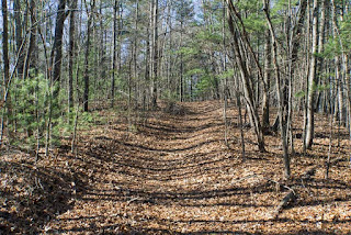
The next trail we wanted to check out was the Table Rock Trail which is off of Joanna Rd. We had recently gone this way to find the decommissioned Joanna Mountain Trail, and stopped short of the Table Rock Trail. Joanna Rd begins as mostly gravel when it turns off of Conservation Rd, but gradually narrows the further it gets away from it. By the time we reached the Table Rock Trail, it had narrowed to one lane and was covered in leaves. Not may hikers come this way - mostly mountain bikers and horseback riders.
 |
| Joanna Rd at the Table Rock Trail |
 |
| Table Rock Trail |
The Table Rock Trail is an out and back trail listed at 0.88 miles. It's also fairly easy with some ups and downs, but not much real change in elevation. The trail actually drops in elevation until near the end where it heads up to the knob known as Table Rock. I'm not sure why it's called this as there are no flat rocks to be seen. The knob is covered with trees and we had a very obscured view of Lake Julia below. I'm guessing there would be no view when the leaves are on the trees. Even though there's not much to see, the trail is a nice stroll through the woods and you're not likely to see very many people - if any.
From here we headed back to the parking area via Joanna, Conservation, and Buck Forest Roads. We still had some time to kill, so I suggested we check out the nearby Merry Falls. It's not on DuPont property, but is very close. Here are the directions from my site. I've only been to this waterfall once and that was quite a few years ago. From what I remembered, the gravel road has been improved with a little more room to pull off.
 |
| Merry Falls from the road |
 |
| Merry Falls from down the 'trail' |
The creek and falls still had quite a bit of water, so getting down for a better view and shot wasn't an option today without getting my feet wet. It's another falls I've added to the list to return to in greener times.


No comments:
Post a Comment