I did a little research online for info about the hike to these 3 waterfalls, but there isn't a lot that has been posted. Firewater Falls is an especially interesting area as you can see from the video. Parking for this hike is at the Caesars Head State Park visitor center. Like a lot of areas in South Carolina, there is a $2 per person fee for using the trails. This is very reasonable and I wouldn't mind if NC did the same for more areas, as long as the money were used for trail maintenance and improvements.
The hike begins on the Frank Coggins Trail which is on the opposite side of 276 from the visitors center. Before we got packs on, I went across the road to get a money envelope, but they were all wet and were falling apart. I went into the visitor center to see if they had any more and they said I could just pay there, so if you do the hike, keep that in mind.
The hike begins along a gravel drive, but soon narrows down to a footpath through the woods. Not too far into the hike, we noticed some idiot had spray painted FBG on the end of a sawed log and on a tree. The trail leads to the top of the first waterfall on the list - Cliff Falls. That same idiot had spray painter a rock at the very top of the waterfall also! It really takes a special kind of ignorance to carry a can of spray paint - or anything - on a hike just do you could deface a natural area. You can see it in the picture below. They actually spelled out what FBG stands for.
 |
| top of Cliff Falls |
I knew from pictures that I had seen that there was a way to get to the base of Cliff Falls. The Rim of the Gap Trail turns to the left just after the bridge and the scramble trail down to the base is a short ways down this trail. There was some ice in the spray zone of the falls, so we weren't able to rock hop around for different views of the falls, so a return trip is definitely in order. The map indicates at least 150' more feet of drop below this and that needs investigating also. This part of the falls is about 20' high.
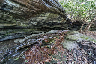
Next waterfall on the hike is Firewater Falls. It's only 0.3 miles up the trail and I really wasn't expecting much here. All the pictures I saw online were just of the waterfall and none showed the big rock area that extended beyond the falls. You can see that in the video. We ended up spending more time here than at the other 2 waterfalls mainly because there was a lot of video I wanted to shoot. I saw one photo online that showed the rock where the waterfall is as bone dry, so be prepared for that of you go during a dry spell. It's still a very interesting area.
The last waterfall on this hike is Rockcliff Falls. It's off of the Naturaland Trust Trail which is a short distance up the trail from Firewater Falls. The trail crosses back over 276, then crosses a private driveway a short distance later, then on to the base of the waterfall. This is another waterfall that might be a trickle in drier weather. It's about 40' high and had a lot of down fall on the right side of the falls when we were there. A couple of the write ups for this hike recommended walking back up 276 for 1/2 mile to the visitors center, but I don't recommend that at all. The safest option is to retrace your path like I mention in the write up on my site.
 |
| Rockcliff Falls |


No comments:
Post a Comment