June 15, 2016 - Waterfalls in the Dennis Cove area of the Cherokee National Forest
Day 2 of our camping trip was dedicated to visiting a few waterfalls in the Dennis Cove area of the Cherokee National Forest close to where we were camped. The first falls of the day was Coon Den Falls. More info and directions to the falls can be found on my web site here. The directions to the trail head we found before the trip seemed pretty straightforward, but turned out to be a little confusing. We passed right by the trail head on Dennis Cove Rd without noticing it even though there is a small carsonite sign marking the trail. There is no parking right at the trail head, so we parked in an area farther down the road and walked back until we found the trail. The trail is a steady uphill climb all the way to the waterfall, but not really very difficult. Water levels in this area are lower than normal, so the waterfall wasn't looking it's best, but it was still worth the hike.
Coon Den Falls
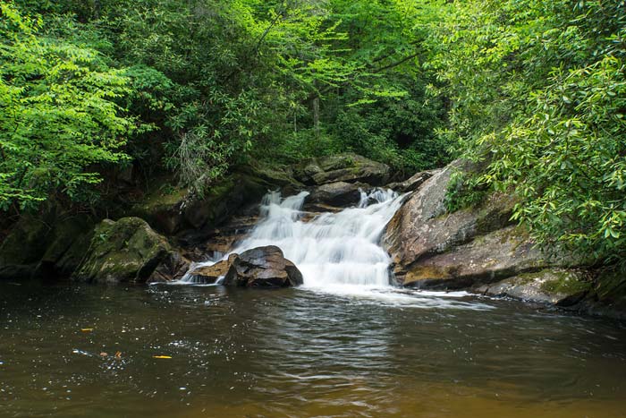
The next waterfalls on our list were along the Laurel Fork Trail which began right across from where we parked for Coon Den Falls. Dennis Cove Falls is on Laurel Fork and is actually 2 separate waterfalls. The hike isn't that difficult, but it requires 3 wet crossings of Laurel Fork. There used to be log bridges with cables at these crossings, but the logs are now gone. The cables are still there, but are basically useless. We knew this ahead of time, so we wore boots that we didn't mind getting soaked. Directions and more particulars on the falls are on my web site here.
The creek crossings weren't that bad, but might have been really dangerous in high water. The first part of Dennis Cove Falls that we came to is considered the lower falls. It's a very small waterfall, but in a very pretty setting. The upper waterfall looked nice in the pictures we saw before we came, but a couple of dead trees have fallen in the middle of the waterfall making it a lot less photogenic. It's still a nice spot, though. Below are photos and video of both. The bird in the video is a Louisiana Waterthrush we saw with what looked to be a salamander in it's mouth. We guessed that we were very close to it's nest at this point and it was trying to tell us to leave.
Lower Dennis Cove Falls
Dennis Cove Falls
The trail map showed a Firescald Falls about a mile and a half farther up the Laurel Fork Trail, and that was our next destination. The hike to it wasn't that bad, but we had several more wet creek crossings to deal with. The little info we found online about this waterfall before the trip showed an easier way to get to it via a gravel forest road and when I go back, that's the way I will go. When we got to a waterfall I recognized from the pictures online, the GPS and map showed we were on Little Laurel Fork. Firescald Branch comes into this up creek a ways, and apparently there are 2 waterfalls right where the creeks meet. Water flow was really puny on this creek and we were getting short on time, so this will be on a return trip to the area.


No comments:
Post a Comment